|
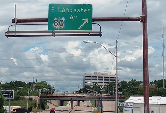
Historically US 80 connected Dallas and Ft. Worth. Although US 80 was decommissioned along that segment in 1993, some evidence of US 80's historical presence in Ft. Worth survived for nearly another three decades. This photo was taken looking north on Beach Street:
0 Comments
Currently the longest single-state mileage of any US route is 893 miles (US 83 in Texas). Historically, before US 101 was truncated to Los Angeles, that route was undoubtedly the record-holder: the California segment of US 101 was about 941 miles (give or take a few, depending on which year, since the alignment changed many times and in many places).
Historic US 99 in California was the second-longest route through a single state, although its mileage is even more difficult to measure, since it was replaced by I-5 in many areas, and as a result some segments of the original route have been vacated. The Historic Highway 99 Association of California offers a length of 917 miles. Although that page does not specify a year, I am sure that figure is reliable, since my own back-of-the-envelope calculation yielded a similar distance. (Note that drivers choosing US 99E between Sacramento and Red Bluff had to travel 2.2 miles further than those who chose US 99W.) Thanks to this blog post, I recently became aware of "the Palm and the Pine" along what is now CA state hwy. 99, just southeast of Madera. In the median of the highway, a palm tree and a pine tree are planted side by side (one representing southern California, and the other representing northern California):
The photo below was taken looking east along the international boundary between Canada (to the left) and the U.S. (right). The large structure (with the flags on top) is the Peace Arch, which straddles the border. (It is not square to the boundary line; rather it is situated at a slight diagonal that roughly matches the angle of the roads that run through here.) If you look closely, you can see three boundary obelisks in the foreground:
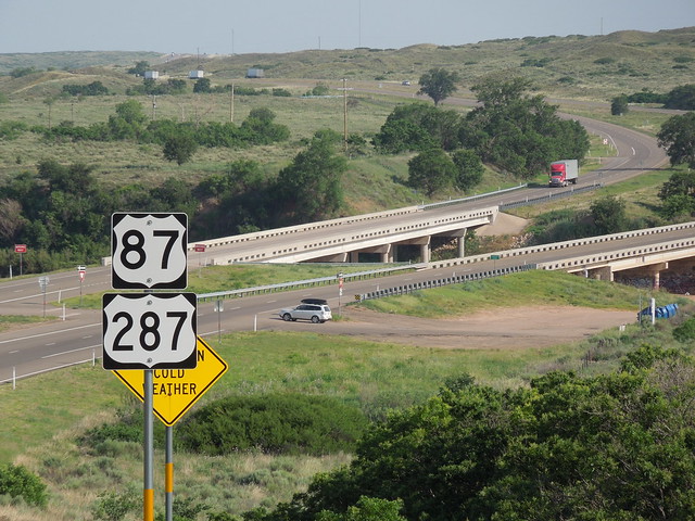
US 87 and US 287 converge in Dumas, Texas, and share about 49 miles of pavement down to Amarillo, where the two routes separate again.
Pretty amazing coincidence...
Heading west from Portland, US 26 enters the path of totality near Mt. Hood, and remains within the path for about 330 miles, all the way to the Idaho border:
(Latest update 7/7/2024) It is common for two different US routes to overlap (meaning they are concurrent along the same highway for a certain distance before splitting apart again). It is less common for three (or even more) US routes to overlap. For example, traffic heading west from Cody, Wyoming, towards Yellowstone is on US 14, US 16, and US 20 (all at the same time).
|
AuthorCategories
All
Archives
July 2024
|


 RSS Feed
