|
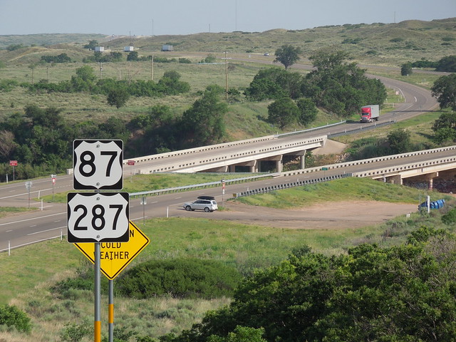
US 87 and US 287 converge in Dumas, Texas, and share about 49 miles of pavement down to Amarillo, where the two routes separate again.
Before reaching their point of divergence, however, drivers on US 87-287 are directed through downtown Amarillo via surface streets. In hundreds of cities (or perhaps even thousands), US highway traffic bifurcates into one-way couplets (i.e. two separate streets, where the first carries one direction of traffic, and the second carries the opposite direction). In the U.S. we drive on the right side of the road, and opposing traffic is to the left. Because of that, in nearly every case where traffic bifurcates, the road carrying opposing traffic is one block to the driver's left (so that when traffic reconvenes onto the same road again, opposing directions of traffic have no need to cross each other).
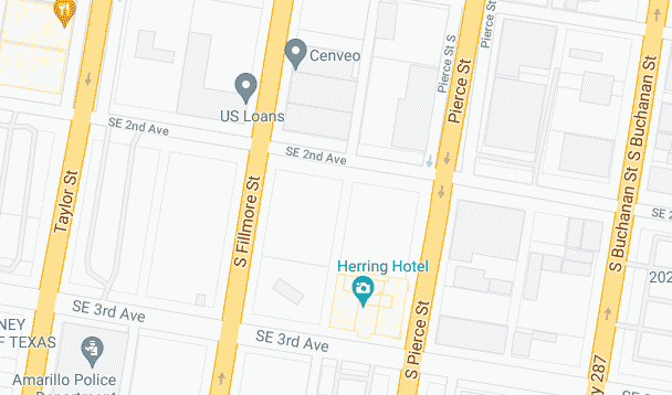
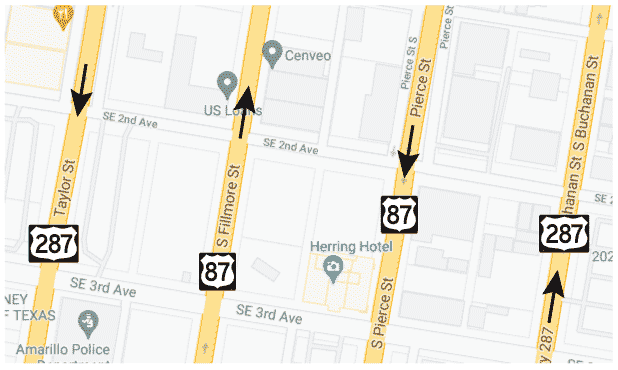
Amarillo is not unusual in the sense that its US highway traffic also splits onto separate roads. However, transportation planners there implemented a twist on this concept by using not just two streets for highway traffic, but four (two for southbound and two for northbound). In other words, at NE 14th Avenue, southbound highway traffic can choose from two options (Taylor Street or Pierce St). Either one can be used to pass through the city, because the two roads reconnect at SE 14th Av. Likewise, northbound traffic has two choices (Fillmore St or Buchanan St), which diverge at SE 14th and converge at NE 14th. Google Maps illustrates the arrangement thus:
Zooming in a bit, the one-way arrows are visible:
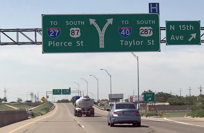
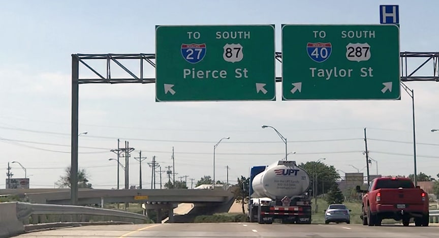
Now we will take a look at how those roadways are signposted. These next two photos were taken from southbound US 87-287. US 87 (and traffic bound for I-27) is directed to use the easternmost of the two options (Pierce), while US 287 (and I-40) traffic is routed along the western road (Taylor):
The sign bridge in the distance is shown close-up below:
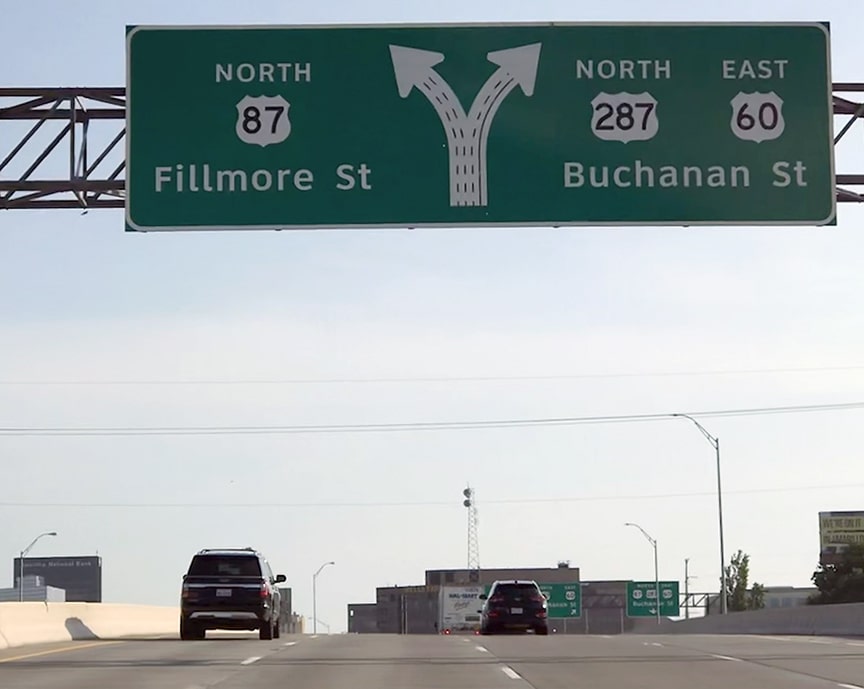
Now let's take a look at signage for traffic heading the opposite direction (northbound approaching downtown):
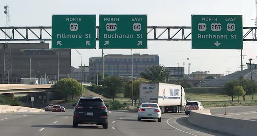
There you can see that US 87 traffic is directed to use the westernmost option (Fillmore) while US 287 traffic uses the eastern road (Buchanan). (US 60 traffic also uses this segment, but we will mostly ignore that route here since it does not factor into this discussion.) The sign bridge visible in the distance is shown close-up below:
The two signs at left are for the benefit of drivers coming from eastbound I-40 or northbound I-27 (which is also nb US 87 and eb US 60). But traffic on the other side of the jersey barrier (at far right) is coming from westbound I-40 (which is also nb US 287). A third sign is posted for those drivers; note that sign (at far right) references all three routes. That is because drivers on that slip ramp do not have the option to directly connect to Fillmore. So for drivers in that lane, in addition to US 287 traffic, US 87 traffic is also directed to follow Buchanan.
To recap so far: US 87 traffic is directed to use Pierce and Fillmore, while US 287 drivers are directed along Taylor and Buchanan. So in other words, the Amarillo situation is not typical in this sense: whichever route one happens to be driving, the opposing direction of that same route is not the next block to the left. Instead, for drivers on US 287, opposing traffic is three blocks to the left. And for drivers on US 87, opposing traffic is one block to the right. Below, highway shields have been added to the preceding map to illustrate how the roads are signed:
So now we will examine why things are arranged that way. In the preceding photo, we noted that northbound US 287 traffic must use Buchanan, because drivers do not have the option to go north on Fillmore (at least not without making a couple turns). So, given that constraint, why then wasn't southbound US 287 traffic directed to use Pierce (the street one block left of Buchanan)? After all, since Pierce and Taylor rejoin at the south end of the bifurcation, either highway could have been routed down either street. So US 287 could have used the eastern couplet (Buchanan and Pierce), and US 87 could have used the western couplet (Fillmore and Taylor).
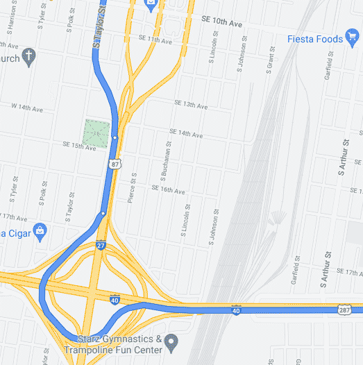
While that is technically true, here is why I think TXDoT chose to direct southbound US 287 traffic onto Taylor (instead of Pierce). Recall that southbound US 287 continues via eastbound I-40. From the point where Pierce and Taylor reconverge on the south, only two blocks remain before I-40 / US 287 traffic must exit to the right. So if US 287 traffic followed Pierce, drivers would have only a short distance in which to cross over into the right lane. But by putting US 287 on Taylor instead, US 287 traffic is already in the right lane, and therefore does not need to make any lane changes in order to remain on US 287. The routing of southbound US 287 traffic is illustrated below:
0 Comments
Your comment will be posted after it is approved.
Leave a Reply. |
AuthorCategories
All
Archives
July 2024
|

 RSS Feed
