|
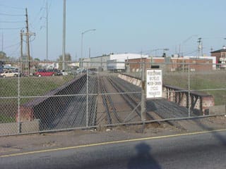
(most recently updated 5/25/2023) In 2001 construction began on Denver's "T-Rex" project (TRansportation EXpansion). This involved widening I-25 and adding light-rail service along the corridor through the south metro area. It was a great investment benefitting Denver commuters, but one unfortunate casualty was the old Colorado and Southern Railway bridge over I-25 (and unmarked US 87), just north of Evans Avenue. The rail line had not been used for years, but its bridge was a cool landmark that provided a little extra character in south Denver. Here is a modern view looking northwest along I-25 from the Evans Avenue overpass. For reference, the white office building behind the center of the bridge arch is on the west side of Colorado Boulevard: 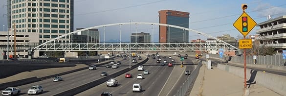 Sanderson, Dec. 2016 Historically, the old C&S bridge was a prominent feature in that direction. This photo was taken from nearly the same spot, several years earlier: 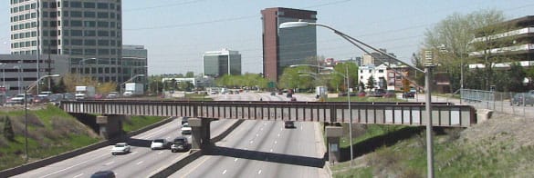 Sanderson, 2002 When I heard that the bridge was to be dismantled, I went and took most of the photos shown on this page. This was a close-up from the same perspective: 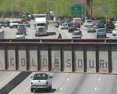 Sanderson, 2002 These next shots were looking the opposite direction, from the frontage road that runs along the east side of the freeway, between Evans and Colorado. The cars at bottom were on southbound I-25:  Sanderson, 2002 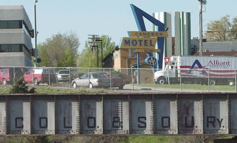 Sanderson, 2002 That truck was on eastbound Evans; the other cars were southbound on the west frontage road (which is now just an offramp). I like that old Cameron Motel sign, too, and I am glad to hear it is being preserved despite the fact that the hotel building itself has since been razed. This shot was also taken from the east frontage road, looking mostly west across the old bridge, but also a bit north, in the middle of an otherwise cardinal street pattern: 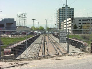 Sanderson, 2002 Even though the tracks between there and Colorado Blvd have been gone for years, the old right-of-way is still evident from the property lines: note how both structures on the right have the same angle as the railroad. Just to the west of I-25, a short segment of the old ROW is now used for the light-rail line. And on the west side of Colorado Blvd, the old railway ran parallel to Buchtel Boulevard. When my wife was growing up during the 1970s, she lived a couple doors off Buchtel, and she remembers the trains going past her street. I'm certainly no railroad buff (so someone correct me if I'm wrong), but from what I have found, this railroad was originally built in 1881:
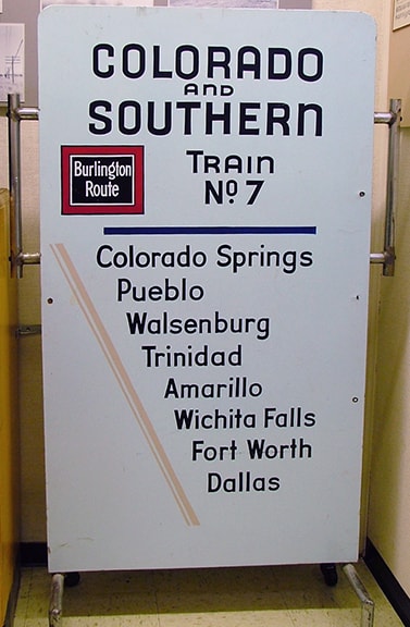
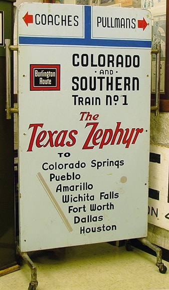
 Sanderson, 2002 Not far in that direction is Dahlia Street. To this day, some of the old rails still exist between Dahlia and Holly Street (just to the south of Asbury Avenue). Even though the C&S RR apparently folded in 1935, the old tracks were still in use as far east as Holly until sometime in the 1970s. On the west side of Holly, between Asbury and Pacific Place, there was formerly a grain storage facility that was used to load up the railcars. That building was later converted into a restaurant (I remember for a time it was called "Rosie Bottoms Nightclub"), but it was later demolished and now a self-storage facility occupies its former location. People who do not realize that a railroad historically cut through this part of Denver may see all these odd, slightly-diagonal lot lines and might well wonder what was going on when this place was laid out. Heading southeastbound back in the day, these vintage signs (now housed in the Colorado Railroad Museum) indicate where travelers could ultimately end up:
In about 2014, a pedestrian bridge over I-25 was installed in almost the same location as the historic railroad bridge (shown in the first photo on this page). It would have been really cool if the old RR bridge could somehow have been repurposed for that function, but unfortunately that was not meant to be. If you have memories of the old Colorado and Southern railroad in Denver, please share them in the comments section below.
0 Comments
Your comment will be posted after it is approved.
Leave a Reply. |
AuthorCategories
All
Archives
July 2024
|
 RSS Feed
Copyright © 1998-2024
