US Ends .com
  • Home
  • Store
    • US highway map
    • Florida US highway map
  • Endpoints
    • US 1 - US 9 >
      • 1 >
        • 201
        • 301
        • 401 [i]
        • 401 [ii]
        • 401
        • 501
        • 601
        • 701
      • 2w >
        • 102
      • 2e >
        • 202
        • 302
      • 3
      • 4 >
        • 104
      • 5
      • 6 >
        • 106
        • 206
      • 7
      • 8
      • 9 >
        • 109*
        • 209
        • 309
    • US 10 - US 19 >
      • 10 >
        • 110
        • 210
        • 310
        • 410
      • 11 >
        • 111
        • 211
        • 311
        • 411 [i]
        • 411 [ii]
        • 411
        • 511*
        • 611
        • 711*
      • 12 >
        • 112
        • 212
        • 312
      • 13 >
        • 113
        • 213
      • 14
      • 15
      • 16 >
        • 116
        • 216
      • 17 >
        • 17-1
        • 117 [i]
        • 117
        • 217
      • 18 >
        • 118
        • 218
      • 19 >
        • 119
        • 219
        • 319
    • US 20 - US 29 >
      • 20 >
        • 120
        • 220
        • 320
        • 420
      • 21 >
        • 121 [i]
        • 121
        • 221
        • 321
        • 421
        • 521
      • 22 >
        • 122 [i]
        • 122 [ii]
        • 222
        • 322
        • 422e
        • 422w
        • 522
        • 622*
      • 23 >
        • 123 [i]
        • 123
        • 223
      • 24 >
        • 124
        • 224
      • 25
      • 26 >
        • 126
      • 27 >
        • 127
        • 227
      • 28
      • 29 >
        • 129
    • US 30 - US 39 >
      • 30 >
        • 130
        • 230
        • 330
        • 430
        • 530
        • 630*
        • 730
        • 830
      • 31 >
        • 131
        • 231
        • 331 [i]
        • 331
        • 431
      • 32
      • 33
      • 34
      • 35
      • 36 >
        • 136
      • 38 >
        • 138
    • US 40 - US 49 >
      • 40 >
        • 140
        • 240
        • 340
      • 41 >
        • 141
        • 241 [i]
        • 241 [ii]
        • 341
        • 441
        • 541
        • 641
      • 42
      • 43
      • 44
      • 45
      • 46
      • 48 [i]
      • 48 [ii]
      • 48
      • 49
    • US 50 - US 59 >
      • 50 >
        • 150
        • 250
        • 350
        • 450
        • 550
        • 650
      • 51 - 55 >
        • 51 >
          • 151
        • 52 >
          • 152
        • 53
        • 54 >
          • 154
        • 55
      • 56 >
        • 156
      • 57
      • 58 >
        • 158
        • 258
      • 59 >
        • 159
        • 259
    • US 60 - US 69 >
      • 60 >
        • 160
        • 260
        • 360
        • 460
      • 61 - 65 >
        • 61 >
          • 161
        • 62
        • 63 >
          • 163 [i]
        • 64 >
          • 164 [i]
          • 164 [ii]
          • 264
        • 65 >
          • 165
      • 66 >
        • 166
        • 266
        • 366 [i]
        • 366 [ii]
        • 466
        • 566
        • 666
      • 67 >
        • 167
      • 68 >
        • 168
      • 69 >
        • 169
    • US 70 - US 79 >
      • 70 >
        • 170
        • 270 [i]*
        • 270
        • 370
        • 470
      • 71 >
        • 171
        • 271
        • 371 [i]
        • 371
      • 72 - 76 >
        • 72
        • 73
        • 74
        • 75 >
          • 175
          • 275
        • 76 >
          • 176
          • 276
      • 77 >
        • 177
        • 277
        • 377
      • 78 >
        • 178
        • 278
        • 378
      • 79
    • US 80 - US 89 >
      • 80 - 84 >
        • 80 >
          • 180 [i]
          • 180
          • 280
          • 380
        • 81 >
          • 181
          • 281
        • 82
        • 83 >
          • 183
          • 283
          • 383
        • 84
      • 85 - 89 >
        • 85 >
          • 185
          • 285 [i]
          • 285
          • 385 [i]
          • 385
          • 485
        • 87 >
          • 187
          • 287
        • 89 >
          • 189 [i]
          • 189
    • US 90 - US 99 >
      • 90 - 94 >
        • 90 >
          • 190
          • 290
        • 91 >
          • 191
          • 491
        • 92 >
          • 192
        • 93
        • 94
      • 95 -98 >
        • 95 >
          • 195
          • 295
          • 395
        • 96 [i]
        • 96
        • 97 >
          • 197
        • 98
      • 99 >
        • 199
        • 299
        • 399
    • Anomalies >
      • 101
      • 163
      • 400
      • 412
      • 425
  • Places
    • A-L >
      • A >
        • Aberdeen
        • Albuquerque
        • Amarillo
        • Apalachicola
        • Astoria
        • Atlantic
      • B >
        • Baltimore
        • Baton Rouge
        • Bay Area
        • Bishop
        • Boone
        • Brady
        • Bristol
        • Brownsville
        • Brunswick
      • C >
        • Charleston
        • Chattanooga
        • Chicago
        • Cincinnati
        • Cleveland
        • Cody
        • Corpus
        • Cortez
        • Council Bluffs
        • Covington
        • Crescent
        • Cumberland Gap
      • D-E >
        • Dallas
        • Des Moines
        • Detroit
        • Dothan
        • Douglas
        • El Paso
        • Eugene
        • Erie
      • F >
        • Farmington
        • Flagstaff
        • Florence
        • Fox Valley
        • Franklin
      • G >
        • Gallup
        • Grand Junction
        • Grand Portage
        • Grayling
        • Great Falls
        • Greeley
      • H-I >
        • Hardeeville
        • Harrisburg
        • Holbrook
        • Idaho Falls
        • Int'l Falls
      • J-K >
        • Jacksonville
        • Joplin
        • Junction
        • Kansas City
        • Keokuk
        • Key West
        • Kingman
      • L >
        • Laredo
        • Lewiston
        • Long Beach
        • Los Angeles
        • Louisville
        • Lubbock
    • M-R >
      • M >
        • Mackinaw
        • Madison
        • Maryhill
        • Maysville
        • Miami
        • Midway
        • Miles City
        • Milford
        • Milwaukee
        • Minneapolis
        • Mobile 31
        • Mobile 31-43-45
        • Montgomery
        • Monticello
        • Mount Vernon
      • N-O >
        • Nags Head
        • Naples
        • Natchez
        • New Castle
        • New Orleans
        • Niagara
        • Norlina
        • Ocean City
        • Oklahoma City
      • P >
        • Pee Dee
        • Pembina
        • Pensacola
        • Petersburg
        • Philadelphia
        • Piegan
        • Pineville
        • Port Arthur
        • Portsmouth
      • Q-R >
        • Quad Cities
        • Rapid City
        • Raton
        • Reading
        • Richmond
        • Rockingham
        • Rouses Point
    • S-Z >
      • S >
        • San Antonio
        • San Antonio NM
        • San Diego
        • Santa Fe
        • Savannah
        • Sioux
        • Springer
        • Springfield
        • St. Ignace
        • St. John
        • St. Paul
        • St. Pete
      • T-U-V >
        • Tallahassee
        • Tampa
        • Toledo
        • Trinidad
        • Ucolo
        • VA Beach
      • W >
        • Walterboro
        • Waverly
        • West Memphis
        • Wilmington
        • Wilson
        • Wrightsville
      • Y >
        • Yellowstone E
        • Yellowstone N
        • Yellowstone NE
        • Yellowstone S
        • Yellowstone W
  • Highways
    • Map of all endpoints
    • Sources
    • History
    • 1926 almost-routes
    • Intra-state routes
    • Numbering
    • Colors
    • Blog
  • Bonus
    • Colorado >
      • Lowest point
      • Antipodes
      • Toponymy >
        • Roots
      • Colloquialisms
      • Populations
      • Denvers
    • Washington Meridian
    • Watersheds >
      • Headwaters Hill
      • Three Waters Mtn.
      • Parting of the Waters
    • Geo-centers >
      • 48 states
      • 50 states
      • North America
    • State corners >
      • AZ-CO-NM-UT
      • CO-UT-WY
      • CO-NE-WY
      • CO northeast
      • CO-KS-NE
      • CO-KS-OK
      • CO-NM-OK
      • NM-OK-TX
      • NM southeast
      • TX northwest
    • ooss.space
  • Connect
    • Author/history
    • Rationale
    • Contact
    • Contributors
    • Submissions

US Highways Blog

Vintage highway sign photos

1/25/2017

1 Comment

 
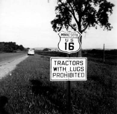
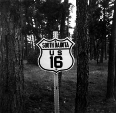
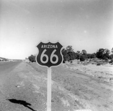
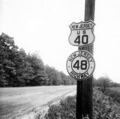
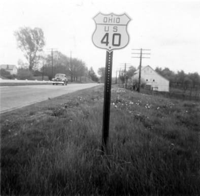
In 2009 my father and my uncle found these photos -- taken by my paternal grandfather during the 1950s -- and gave them to me, knowing I would appreciate them.  That was about 20 years after I had begun taking road sign photos of my own, and until then I had the mistaken notion that I was the first in my family to have this strange hobby.  Is it possible that this sort of thing can be passed down through bloodlines?
That was also about 20 years after my grandpa had passed away, so unfortunately I never had a chance to ask him about these photos.  However, I have been able to discuss it with my dad, as well as with some of my aunts and uncles, and the text that follows is sprinkled with information I have gleaned from them.

​During this time, my grandparents lived in Denver.  I was told that every summer they would drive to the American Baptist Convention, which was always held at a different location.  They usually did not bring their children, so unfortunately my uncles and aunts do not have any recollection of most of these trips.  I was also told my grandpa had a sense of humor, and often the reason he would stop for a photo was because he thought something was funny.  One example of that is shown below, but most of the photos on this page simply show highway signs.  Why did he consider these worthy of a photograph?  We can only speculate, but here is a theory: as grandpa was growing up, reaching adulthood, and starting his family, that was all during a time when cross-country travel was no trivial matter, and it was not something that the average person did very often (if at all).  After WWII, long-distance automobile travel became more popular, so perhaps when grandpa started venturing out more, he was eager to document the places where he had been, and the new sights he was seeing.  Apparently he was very interested in big public works projects, such as dams -- that may be a factor in the last photo below.
Picture
That was my grandpa's car in the background: a white 1941 Chrysler New Yorker, with a "Straight 8" engine and overdrive, which he probably purchased in 1948.  He likely found the notion of "Tractors with lugs" amusing.  Next is another shot from US 16, so it seems likely that it was from the same trip:
Picture
Probably in the Black Hills somewhere -- perhaps this was the route grandpa used to get to a Baptist Convention in Milwaukee or Green Lake, Wisconsin.
Picture
Picture
Historically a handful of states experimented with color-coded highway signs.  Arizona DoT tried this from the early 1950s to the early 1960s.  Arizona based its colors on the direction of the highway: northbound route shields (both US routes and state routes) were orange, and southbound routes were green.  Westbound traffic was reassured with blue markers, while eastbound drivers saw brown markers.  Since the photo above was taken along westbound US 66, that shield would have been blue.  US 89 was overlapped with US 66 along a 52-mile-stretch between Flagstaff and Ash Fork.  Westbound US 66 carried southbound US 89 traffic, so that shield was green (explaining why the two appear to be about the same color in that monochromatic photo).  It is more difficult to locate the shot below. It could have been a blue westbound shield, photographed in the early morning, or else an afternoon photo of a brown eastbound shield:
Picture
Those photos were likely taken on a trip to visit one of their daughters, who by then was married and living in southern California (there may have been a Baptist Convention out that way, too).
Picture
Today NJ hwy. 48 runs only about four miles, from Penns Grove to US 40.  But originally it continued further east, overlapped with US 40 all the way to Atlantic City.  Apparently this duplex was eliminated in 1953, which makes a good case that the photo was taken in or before that year.  The Baptist Convention was in Atlantic City one year, and US 40 would have been an obvious route to use between there and Denver.  Below is another shot from US 40, perhaps taken during the same trip:
Picture
Get your very own map showing all current and historic US routes!
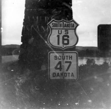
Identifying the location of that last South Dakota photo was pretty complicated, and the fact that it was not a very clear shot did not help.  I will start by getting to the bottom line: I believe this was taken near Chamberlain, at the Missouri River crossing (these two routes were overlapped in that area from 1939-1976, as illustrated on the 1939 USGS topo).  If you dispute this, then you can read on to find out how I arrived at this conclusion, and then contact me if you have reason to believe I am mistaken on any of these points:

Today US 16 begins in Rapid City, and exists only to the west of there, into Wyoming.  SD 47 is a north-south route, running down almost the exact middle of the state.  So today these two routes do not intersect.  However, until 1980, US 16 did continue east of Rapid City, running all the way across SD and into Minnesota, essentially along today's I-90 corridor (in fact, the reason US 16 was eliminated east of Rapid City is because I-90 replaced its functionality).  So prior to 1980 these two routes did intersect (and I-90 was not built through this area until the early 1970s, so prior to that US 16 was the primary east-west route across SD).  SD 47 joined US 16 near the point where the two routes crossed the Missouri River.  However, this introduces another complicating factor: that of Lake Francis Case (an impoundment on the Missouri).  Construction of Ft. Randall Dam began in 1946, and apparently by 1954 enough water was backed up to begin generating electric power (the entire project was completed in 1956.)  The USGS Oacoma quadrangle is dated 1952 (pre-Lake Francis Case), but the Chamberlain quad was 1974 (post-lake). (Iona NW quad was also 1952, and shows the undammed Missouri River, but also indicates areas of future inundation.)  The 1952 quads indicate that SD 47 was overlapped with US 16 between Oacoma and Chamberlain (US 16 crossed the Missouri via a bridge that no longer exists... well, actually it exists, but it's been moved.  Today's Business Loop 90 (King Avenue) bridge is a twin truss bridge.  But one of those bridges was originally about three blocks north of the present location... in fact, some of the old pilings are still there).  This map also indicates the historic routing of SD 47, which went pretty much due north from Iona, on a relatively direct route to Oacoma.  But part of this route was soon to be under water, so apparently it was just a few years later (by 1955) that SD 47 was changed to its current alignment (which heads more northwesterly out of Iona, towards Reliance).

The point of all this is that, if the photo was shot prior to 1955, then the only place it could've been taken was along an approx. three-mile stretch between Chamberlain and Oacoma.  If it was after 1955, then it could've been anywhere between Chamberlain and Reliance (an approx. 10-mile stretch).  However, there appears to be a fairly large body of water in the background.  Just behind the shields there appears to be a structure - perhaps an ornamental gateway of sorts at the bridge approach, or maybe an historical marker - either of which would make sense at the location of a river crossing.  The words visible on the pylon appear to say "American Island", and based on other photos I've found on the web, the full inscription was probably "American Island Park".  This makes sense, because there was indeed such an island in the Missouri near Chamberlain before it was submerged by Lake Francis Case (in fact, this island is even mentioned in the 1804-1806 journals of Lewis and Clark).  Elsewhere on the web I learned that there was a public park of sorts on this island, with a pool, golf course, race track, shooting range, cottages for rent, etc.  Grandpa may have known that this park was soon to be lost forever... maybe that's why he took that photo. 

(This area has changed a lot since this photo was taken.  Today SD 47 runs along old US 16 for about 2 miles near Reliance.  But this has been the case only since about 1976, and the photo was obviously taken long before then.)
1 Comment
Francis Khoury link
8/3/2021 08:47:48 am

Awesome memories. I remember driving across NJ via county routes using Hagstrom maps in the '80s. I can only imagine crossing the USA in the '50s given the roads and maps available then. Must have been a lot of work - but very scenic!

Reply

Your comment will be posted after it is approved.


Leave a Reply.

    RSS Feed

    Author

    This guy.

    Categories

    All
    Arizona
    Boston
    California
    Colorado
    Denver
    Florida
    Geo-center
    Geography
    Historic
    Idaho
    Illinois
    Indiana
    Kansas
    Kentucky
    Maryland
    Massachusetts
    Michigan
    Midpoint
    Mileage
    Minnesota
    Missouri
    Nebraska
    New Hampshire
    New Jersey
    New Mexico
    Newport
    New York
    North Carolina
    North Dakota
    Numbering
    Oddity
    Ohio
    Oklahoma
    Oregon
    Pennsylvania
    Proposed
    Renumbering
    Signage
    South Carolina
    South Dakota
    Tennessee
    Texas
    Updates
    US 101
    US 127
    US 13
    US 136
    US 150
    US 154
    US 16
    US 160
    US 163
    US 164
    US 169
    US 177
    US 183
    US 190
    US 191
    US 20
    US 210
    US 212
    US 218
    US 220
    US 23
    US 24
    US 25
    US 259
    US 26
    US 266
    US 27
    US 270
    US 271
    US 277
    US 281
    US 283
    US 285
    US 287
    US 3
    US 31
    US 311
    US 321
    US 34
    US 36
    US 360
    US 371
    US 377
    US 383
    US 385
    US 40
    US 400
    US 411
    US 450
    US 46
    US 48
    US 491
    US 50
    US 530
    US 55
    US 59
    US 6
    US 60
    US 61
    US 62
    US 63
    US 65
    US 66
    US 666
    US 67
    US 730
    US 74
    US 77
    US 81
    US 83
    US 84
    US 85
    US 87
    US 89
    US 93
    US 94
    US 96
    US 99
    Utah
    Virginia
    Washington
    Watersheds
    West Virginia
    Wyoming

    Archives

    August 2022
    March 2022
    February 2022
    January 2022
    August 2021
    July 2021
    June 2021
    April 2021
    February 2021
    January 2021
    August 2020
    July 2020
    May 2020
    April 2020
    March 2020
    February 2020
    January 2020
    December 2019
    October 2019
    September 2019
    August 2019
    May 2019
    January 2019
    November 2018
    June 2018
    April 2018
    March 2018
    November 2017
    September 2017
    August 2017
    June 2017
    March 2017
    February 2017
    January 2017
    December 2016

Copyright © 1998-2023
Picture