|
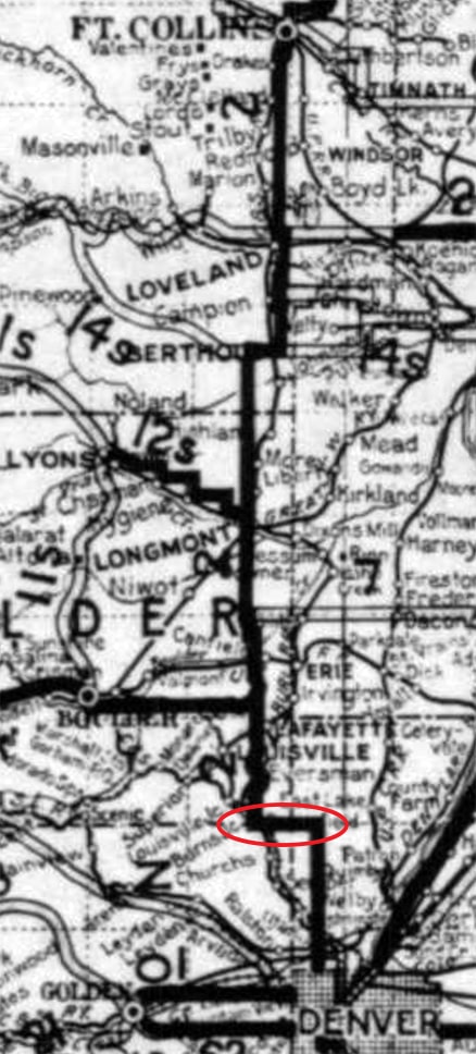
Prior to I-25, there was a different main highway that connected Denver to several of the Northern Front Range cities in Colorado. The number of this highway has changed a few times during the past century, but its general corridor has remained the same: it still runs through Ft. Collins, Loveland, Berthoud, Longmont, Lafayette, Broomfield, Westminster, and Denver. Not all of those cities had even been established at the time of the 1916 map shown below, but the highway corridor running along the Northern Front Range is readily apparent (going forward I will refer to this road as the NFRH, for "North Front Range Highway"):
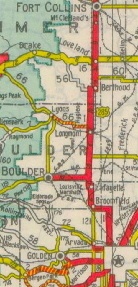
Towards the bottom of that map, notice the jog in the road that is circled in red; this article will focus on that area later. But for now, notice that the NFRH had been assigned a designation of State Highway 2 at the time. About ten years later, a couple major changes took place: the state designation was changed to Highway 1, and when the US route system was established, this same road was initially given the designation of US Highway 285. Both of those numbers were illustrated on the 1931 map below:
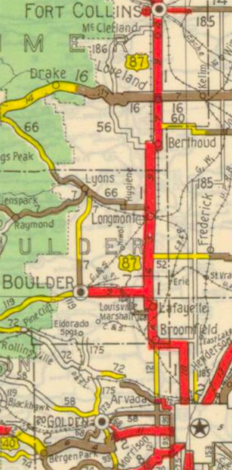
Note that the Denver-Boulder Turnpike would not be built for another couple decades, so until then the NFRH also served as the main route connecting those two cities. But it was not long before the US 285 designation was changed and applied to the same route that carries it today (which heads west and south out of Denver). That happened in 1935, and as a part of the same rearrangement, the US 87 designation was extended southward from Wyoming and applied to the NFRH. That was illustrated on this 1937 map:
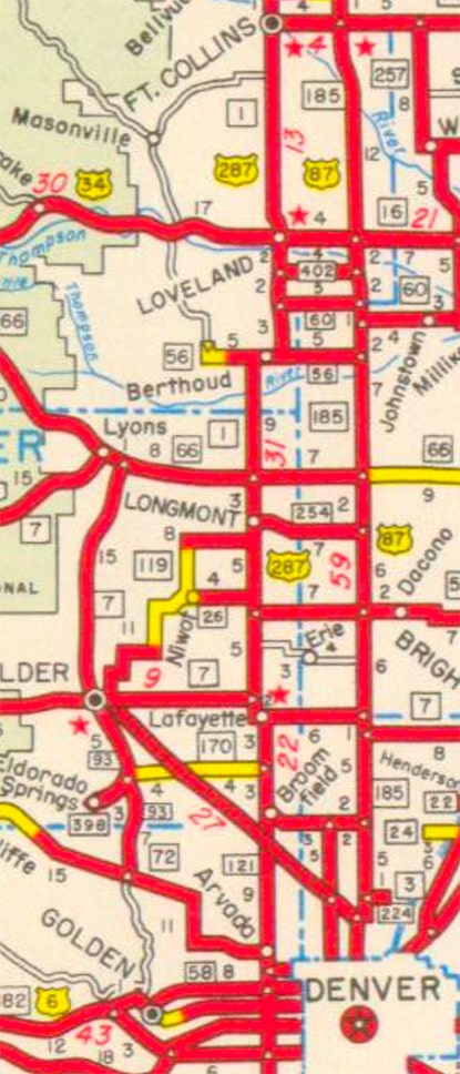
At the time of that map, the south terminus of US 287 was in Ft. Collins, but just a few years later that designation was extended south through Denver with US 87, as shown on this 1941 map:
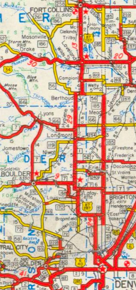
Also illustrated on that map is the partially complete State Highway 185 corridor, which ran parallel to US 87-287 a few miles to the east. When that was fully open to traffic, the US 87 designation was moved over to the new highway, leaving only US 287 on the original NFRH:
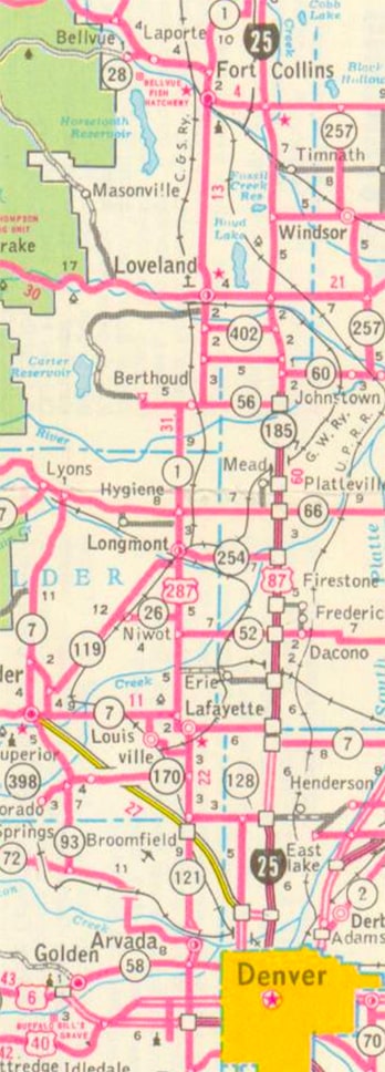
US 87 / SH 185 would eventually become what is now the I-25 corridor. That new designation was first illustrated on early 1960s maps:
To recap so far: the original "North Front Range Highway" has carried the designations SH 2, SH 1, US 285, US 87, and US 287. But the corridor itself has really not changed significantly during the intervening years; the most notable exceptions are as follows:
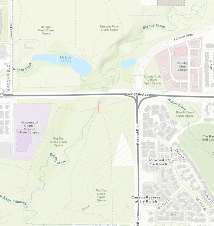
First, let's take a look at a map showing the intersection as it appears today:
120th and Federal is now a pretty standard four-way intersection. To the south of that junction, Federal carries US 287. To the east, 120th carries the SH 128 designation. 120th to the west of the intersection carries both US 287 and SH 128 (which diverge again after about three miles).
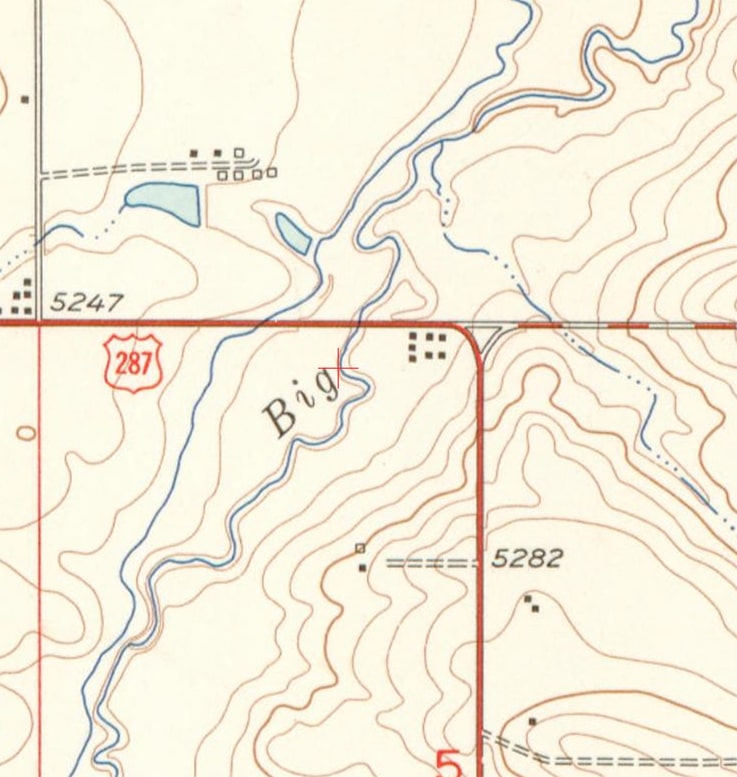
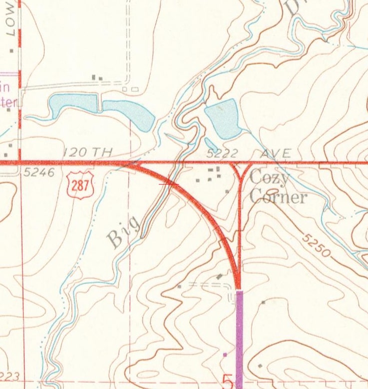
But originally, Federal did not extend north of 120th; for several decades this was just a three-way intersection. It was not a standard "T" junction; rather it was more of a "Y" junction, as illustrated on the 1956 USGS topo map:
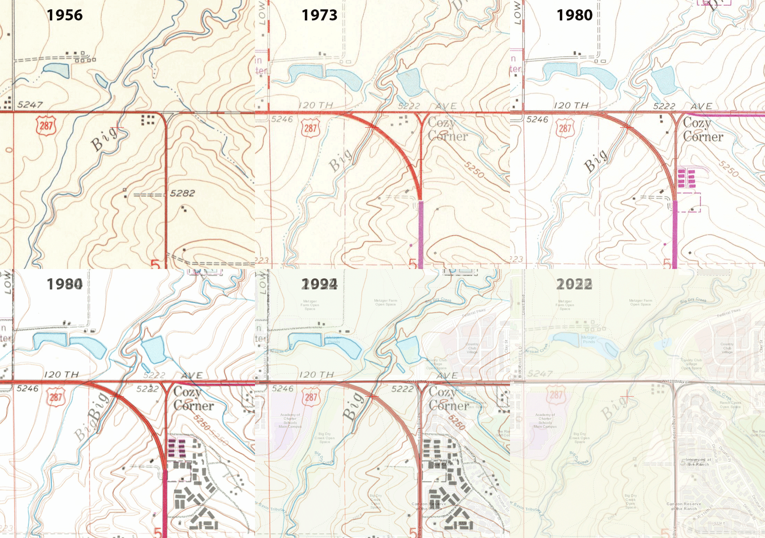
In about 1960, the configuration was changed such that US 287 traffic followed a rather large-radius curve to transition between 120th and Federal. This was a dual carriageway, with separate bridges over Big Dry Creek for the northbound and southbound lanes:
In about 1992, the northbound lane was vacated; instead of using the curve, northbound US 287 traffic continued straight ahead on Federal, and then made a left turn onto 120th. However, the southbound lane was retained as a high-speed slip ramp from eastbound 120th to southbound Federal (I do not have a map illustrating that particular arrangement).
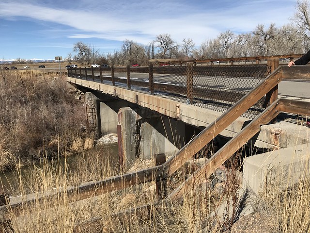
In about 2016, CDoT vacated the remainder of the large-radius curve; all traffic now passes through the four-way intersection of 120th and Federal. The former highway curve is now part of an open space; the pavement was torn up and the old roadbed was re-seeded with natural grasses. At that time the former northbound bridge was dismantled; the one piece of infrastructure that remains is the old bridge which carried southbound traffic over Big Dry Creek. That bridge was repurposed as a segment of a recreational trail. The animated image below shows the changes that have taken place over the years. The red crosshair (just to the south and west of the current intersection) marks the location of the old bridge:
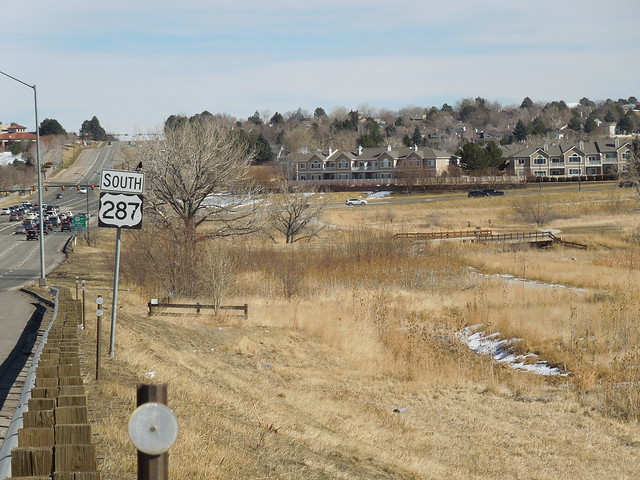
Following are a few 2022 photos to illustrate what can be seen today; this first one was looking east on 120th. Immediately after crossing over Big Dry Creek, SH 128 traffic continues straight ahead, while US 287 turn south on Federal...
...however, if we back up a little ways from there, we have the following view:
The same green sign shown in the first photo is visible in the distance at far left. At far right a concrete bridge is visible; historically southbound US 287 traffic veered off 120th just ahead by curving to the right, crossing that bridge, and connecting with Federal off the right edge of the photo. Below are some close-up views of the old bridge; this next one was still looking the same direction (southbound):
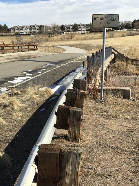
In the foreground you can see that the old metal guard rail remains in place. The photo below was taken just a few steps to the left:
As you can see, the asphalt surface is still there. Originally the bridge carried two lanes of traffic, but when it was downgraded to a slip ramp, it was re-striped for only a single lane. The fencing was added after CDoT vacated the bridge. In the distance the old roadbed can still be seen, curving to the right and rising in elevation. Below is more of a profile view of the bridge, looking the opposite direction:
In that photo can be seen the places where the original guard rail was attached to the side of the bridge deck. If you would like more history of US highways in the Denver area, check out this blog entry.
Additional research: Luke Mullen
2 Comments
Luke Mullen
2/22/2022 01:12:00 pm
Super interesting history of this route. The northboud bridge over Big Dry Creek in Westminster was actually in place (though unused) through 2016, at which point it was dismantled when the whole Federal/120th intersection was redone. You can still see the old bridges in historic Google Street View images.
Reply
2/22/2022 02:17:55 pm
Interesting, thank you! I have revised the text to reflect that.
Reply
Your comment will be posted after it is approved.
Leave a Reply. |
AuthorCategories
All
Archives
July 2024
|


 RSS Feed
