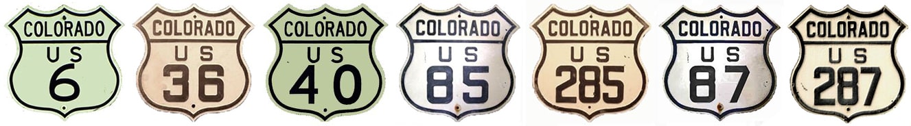
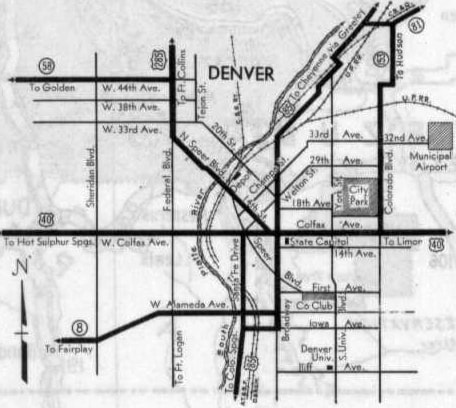
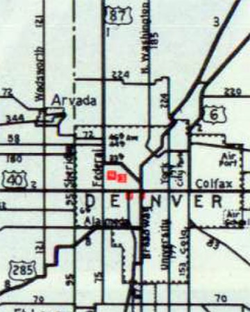
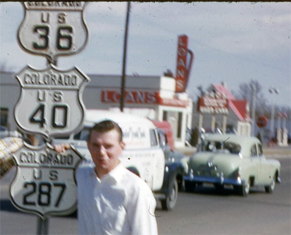
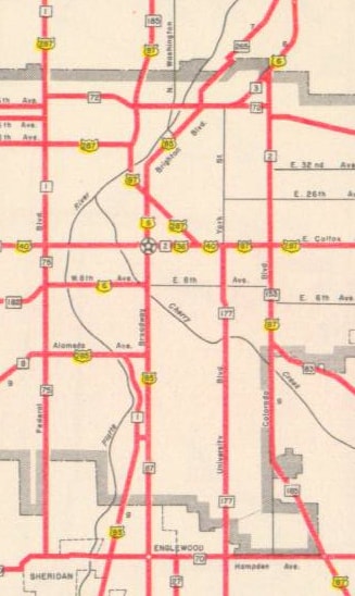
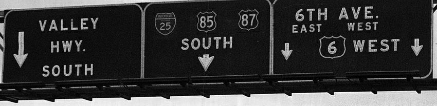
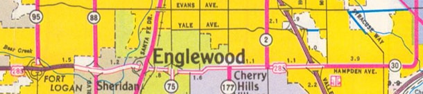
(Most recently updated 3/5/2022.) Today, Denver is served by seven different US routes (shown above), but when the US highway system was first commissioned in late 1926, only three routes went through Denver. AASHO officials acknowledged the city's importance by placing it at the junction of a major north-south route (US 85, which ran from a Canadian port of entry almost to Mexico) and a transcontinental east-west route (US 40, which connected Atlantic City NJ to the San Francisco Bay Area):
c. 1927, Rand McNally

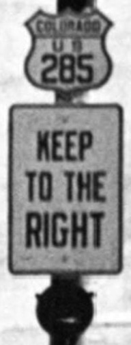
The third US highway serving Denver was US 285, but it was not the same as the route that carries that designation today. Instead of heading west and south from Denver, the original US 285 went north from Denver, essentially following the route of modern US 287 through Broomfield, Lafayette, Longmont, Loveland, and Ft. Collins, ending in Laramie WY. Although US 285 [i] lasted only about eight years, it had various routings through downtown Denver, and multiple termini, all of which are discussed at length on the US 285 page. Also, please note: in order to more easily visualize all of the historic US highway routings in the Denver area, each of them have been overlaid on this interactive map.
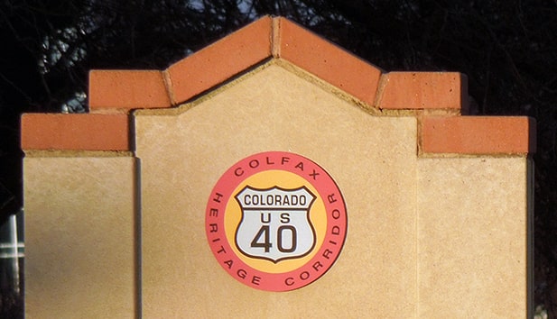
US 40 will not be discussed much on this page... not because it is unimportant, but simply because of the remarkable fact that its routing through Denver has never changed! US 40 still follows Colfax all the way through the metro area: exactly the same route as it did when it was first commissioned nearly 100 years ago. The City of Aurora seems to embrace that history a bit more than Denver itself, referring to it as a "Heritage Corridor" and commemorating it with special street sign blades and with small monuments placed in the median of Colfax: 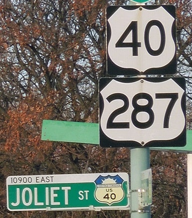
I-70 across the Denver metro was completed in about 1968. At any time since then, the Colorado DoT could have directed US 40 traffic to use I-70 instead of Colfax. Nearly all other US routes in Denver have been moved off surface roads and onto a parallel freeway, but for some reason CDoT has never done that with US 40.
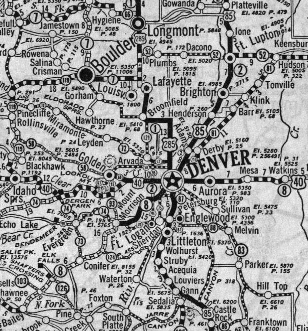
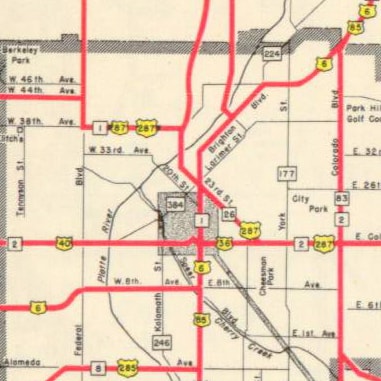
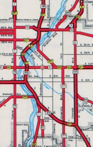
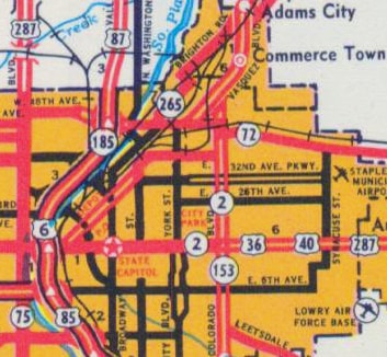
Contrast that with US 85: its original route between Overland golf course and Commerce City was over surface streets, 11 miles in length. But by 1958, US 85 traffic had been removed from that entire route, instead following newer freeways and expressways. Since then, the distance between those two points is 13 miles, but of course travel time is much faster than the historic route. Exactly what route did historic US 85 traffic use? Take a look at one of the earliest detailed maps of Denver showing US routes:
c. 1931, CDoT
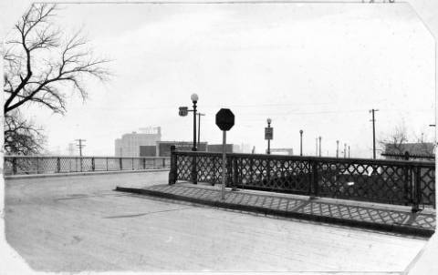
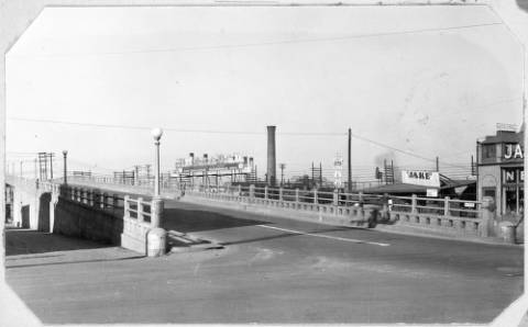
Heading south from what is now Commerce City, US 85 originally followed the road currently designated as state highway 265. That is, southwest on Brighton Boulevard to Riverside Cemetery, where it makes a sharp turn and passes underneath a railroad by way of a very narrow tunnel. Continuing on from there, the SH 265 designation ends at its junction with I-70, but US 85 continued further southwest on Brighton Blvd, all the way to the point where it curves due south and becomes Broadway. Today Broadway is one-way southbound, but historically it carried both north and south traffic. This photo was taken looking north on Broadway at Walnut Street, at the south beginning of the viaduct:
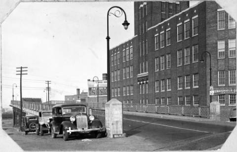
c. 1937 (linked to source at Denver Public Library)
On the lamp post at far right were some highway signs, shown enlarged here:
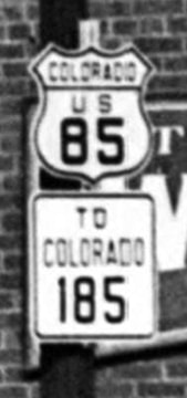
(detail)
(Incidentally, SH 185 was a highway that began by heading north from Brighton Blvd via 38th Street, which curves to become Washington Street; that was the highway that eventually became I-25.) Heading south from the Broadway viaduct, US 85's junction with US 40 (and probably US 285 as well) was right at the State Capitol. From Colfax, US 85 continued south on Broadway for another 2.5 miles. At Iowa Avenue, US 85 turned west to pass underneath a railroad, before turning south again on its present route (Santa Fe Drive).
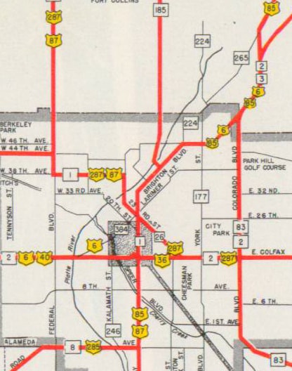
Through 1935, aside from the previously-mentioned changes to the south end of US 285, there were no other alterations to US routes in Denver. But 1936 was a year of several changes to US routes all across the West, and some of these impacted Denver. For one thing, US 285 no longer went north from Denver, and it no longer served the downtown area. Instead, US 285 began in South Denver by heading west from US 85 (Broadway) via Alameda Avenue. That change and others were illustrated on this map:
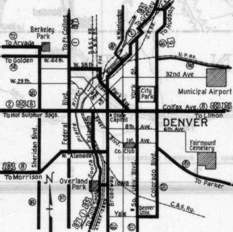
c. 1937, CDoT
This photo was taken from Santa Fe Dr, looking east along Alameda:

c. 1938 (linked to source at Denver Public Library)
Although that segment of Santa Fe does carry the US 85 designation today, at the time of that photo the junction with US 85 was about a half-mile ahead, at Broadway. Some traffic signs were mounted on the pole in the median; they are shown close-up here:
(detail)
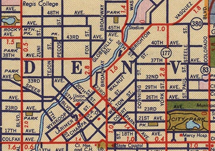
Another change illustrated on the map above was the US 87 designation, which was rerouted in Wyoming and extended south into Colorado. It came into Ft. Collins and replaced the original US 285 all the way down to Denver (the remaining segment of former US 285 between Ft. Collins and Laramie became part of the new US 287 designation). From downtown Denver, instead of following Park Avenue southeast all the way to Colfax (as US 285 had done), US 87 joined with US 85 by turning south on Broadway, and those routes were twinned out of town (and actually all the way through the rest of Colorado, finally diverging at Raton NM). However, maps from just a little later (approx. 1938-1941) showed US 87 using an even older US 285 routing to get to Broadway, specifically 33rd Av - 20th St:
c. 1939, CDoT
c. 1940, Rand McNally
The original 20th Street Viaduct had opened in 1911 (it was replaced by the current viaduct in 1994). Already by the 1942 issue, the state highway map showed US 87 back on the 38th Av - Fox St - Park Av routing, so if US 87 truly used 33rd Av - 20th St only for a period of about three years, then highway historians are very fortunate to have access to this photo of the old 20th Street Viaduct...
c. 1940 (linked to source at Denver Public Library)
...because it was taken during the very brief timeframe when it was signposted as US 87 (enlarged here):
(detail)
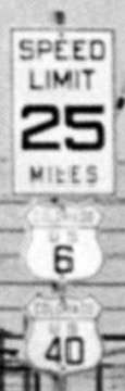
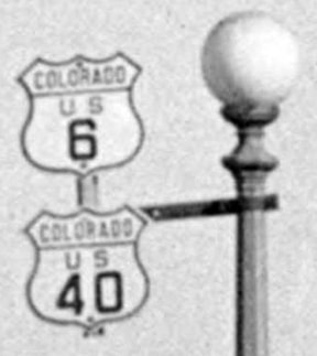
In 1937 (one year after US 87 was extended through Denver, and US 285 was changed) two additional US highways were routed into the city. The US 6 designation (which had previously ended in Greeley) was truncated at Wiggins and instead extended southwest through Denver (and through the remainder of Colorado, all the way to Long Beach CA). US 6 came into Commerce City heading southwest on the road that is now designated SH 2. At 64th Avenue traffic curved to head due south on Dahlia Street (this is before Vasquez Boulevard had been built, which would later subsume that segment of Dahlia). At the time, Dahlia had a bridge over Sand Creek, and just south of there was a diagonal road (completely gone now) connecting Dahlia (at about 5400 North) to Colorado Boulevard (at about 4900 North). US 6 traffic then continued south on Colorado to Colfax. Initially US 6 was not routed along 6th Avenue (as it is today), nor did it go through Clear Creek Canyon west of Golden. Rather, US 6 was twinned with US 40 from the intersection of Colorado and Colfax, west into the mountains, all the way to Empire Jct. (a distance of about 43 miles). Following are a few historic photos with signs marking the US 6-40 overlap, each of them from somewhere along the Colfax viaduct. This first one was taken looking west, possibly at the east beginning of the viaduct:
c. 1938 (linked to source at Denver Public Library)
To the right of the tall smoke stack is a signpost, shown in detail here:
(detail)
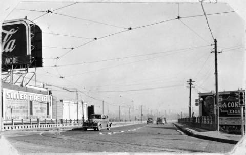
This next photo was also looking west along Colfax. I believe the photographer was standing at the southwest end of the Larimer viaduct:
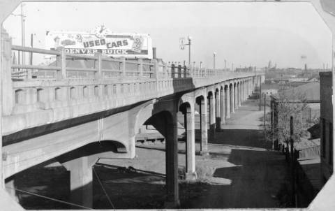
c. 1938 (linked to source at Denver Public Library)
To the right of the Buick billboard some signs are mounted on a lamp post, shown close-up here:
(detail)
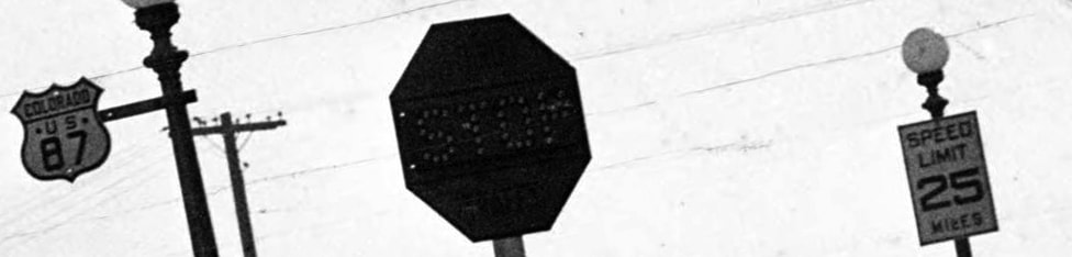
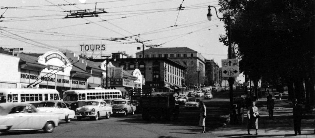
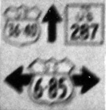
This image was taken looking the opposite direction (east on Colfax):
c. 1938 (linked to source at Denver Public Library)
A close-up look at the signs posted at far right reveal that the cross street was Federal Boulevard, which carried the SH 75 designation at the time (as shown on the 1937 and 1939 CDoT maps above):
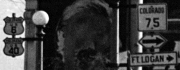
(detail)
The other route that was extended to Denver in 1937 was US 36. It appears that this was done in order to connect it with US 6, and maps suggest that over the next three decades, there were four different locations in Denver for west terminus of US 36, which changed every time the route of US 6 changed (that is discussed in greater detail on the historic US 36 page).
Two years later, in 1939, the last of seven US route designations was extended through Denver: US 287 was twinned with US 87 from Ft. Collins to Denver (this blog post has more about the history of that route between Denver and Ft. Collins). Initially the two routes diverged at 38th and Federal, using different paths through the downtown area: 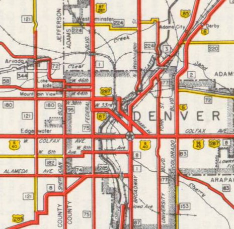
c. 1940, CDoT
From there, US 87 continued to head south with US 85, while US 287 turned east on Colfax. So for about the next 30 years, Colfax carried not only US 40 and US 287, but also US 36:
(Some postcards referencing this triple concurrency can be viewed here, here, and here.) The 1941 issue was the last to show any US route on the 33rd Av - 20th St corridor. The 1942 issue showed US 87-287 twinned along 38th Av - Fox St - Park Av until their diversion point at Broadway:
c. 1942, CDoT
Another change was illustrated on that map: Vasquez Blvd was built as a diagonal heading northeast from 46th and Steele Street. Its northern segment overlaid Dahlia, but was also extended due north across several rail lines. So US 85 was removed from a 3.5-mile segment of Brighton Blvd; instead traffic was directed southwest on Vasquez, then west on 46th Avenue to Brighton Blvd.
By about 1944, US 6 had been changed in a similar way: traffic was removed from Colorado Blvd, and instead twinned with US 85 along Vasquez - 46th - Brighton Blvd - Broadway. These non-standard signs found in Commerce City 35 years later probably dated back to the 1950s, shortly after the US 6-85 overlap was initially created: 
Summa, 1979
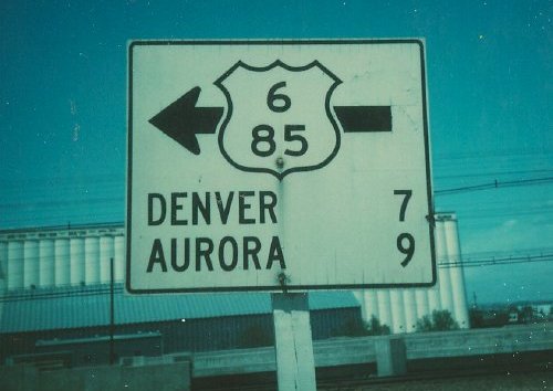
Summa, 1979
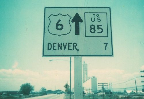
Summa, 1979
From Broadway, US 6 split from US 85 by turning southwest on Larimer Street, which connected with the previously-existing route of US 6 at Colfax:
c. 1947, CDoT
Commercial maps from the same timeframe also showed Larimer as a signed highway:
c. 1947, Gousha
The earliest map I have seen showing US 6 on Larimer was CDoT's 1946 issue, but their 1947 version (above) was the first to show a US 36 marker west of Colorado Blvd, suggesting that US 36 had been extended in order to maintain its connection with US 6. However, that arrangement did not last long; in about 1951, US 6 was changed again:
c. 1952, CDoT
Instead of following Larimer to Colfax, US 6 traffic remained on Broadway down to 8th Avenue. This photo was taken during that timeframe:
c. 1953-1958 (linked to source at Denver Public Library)
(detail)
That was taken looking east from Broadway on Colfax (or east on US 40). At the time, straight ahead on Colfax was also the west beginning of US 36 (and the upper right sign noted "TO US 287", which came in on Park Av about 16 blocks ahead and joined Colfax). Note that Broadway was carrying not only US 85, but also US 6. Westbound traffic on that route continued south (to the right in that photo) to 8th Av, where it was then directed to turn west. Just past Federal, the road curved south to align with 6th Avenue. US 6 followed this new alignment all the way out to Golden. In addition, traffic followed a brand-new route to the west of Golden which had been built through Clear Creek Canyon. In fact, a couple other big highway projects along the Front Range were completed right about that same time, including the Denver-Boulder Turnpike (future US 36), and a new highway between Denver and Castle Rock (future US 87/I-25). CDoT was quite proud of all three projects:
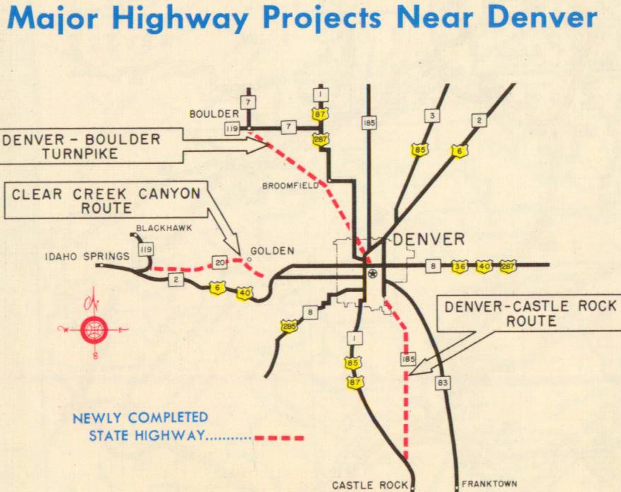
c. 1952, CDoT
For a brief time, the road that is now designated I-25 was complete both to the north and to the south from Denver, but not through the central part of the city. It was during this time that the US 87 designation was removed from its pairings with US 85 to the south and US 287 to the north, and instead applied to the new road. The separate freeway segments of US 87 were temporarily connected via Fox St - Park Av - Colfax Av - Colorado Blvd:
c. 1954, CDoT
c. 1956, Gousha
Today's I-25 (at the time referred to as the "Valley Highway") was complete all the way through Denver in 1958. That resulted in changes to several of the US routes in the area. US 87 traffic was directed to follow the new freeway all the way through the Front Range. US 6 and US 85 were directed further west on 46th Av / future I-70, so that traffic could then jump on the new freeway. As a result, US 36 was probably extended west from Broadway, in order to continue connecting to US 6. The 6th Avenue Freeway was extended east to the new Valley Highway, so US 6 was removed from 8th Av, instead following 6th Av all the way across the west side of Denver (its current route). US 85 was extended further north along Santa Fe Dr in order to connect with the Valley Highway (also its current route). In other words, 1958 was the last year that any US highways were routed along 8th Av, Colorado Blvd, Brighton Blvd, Broadway, or Iowa Av. And since Broadway no longer carried US 85, the US 285 designation was truncated by about a half-mile, such that it ended at the new US 85-87:
c. 1959, CDoT
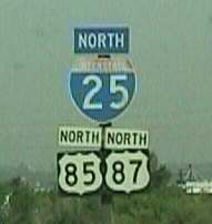
The I-25 designation was not officially applied to the Valley Highway until about 1962, and even then it may not have been signed as such immediately. So for the first few years the freeway was signed simply as US 87, as can be seen at lower right in this photo:
c. 1961, Peter Appleton (Denver Post)
The segment between 6th Av and 46th Av (future I-70) was additionally posted with US 6 and US 85 shields, and the segment from 6th to Santa Fe was dual-signed as US 85-87:
c. 1964 (attribution unknown; linked to similar photo at Denver Public Library)
The following year (1959) was the last time US route traffic used the Fox St - Park Av route through downtown area, as US 287 traffic was directed to simply remain on Federal down to Colfax, thus attaining the same routing that it uses to this day:
c. 1960, CDoT
In 1960, the segment of today's I-76 between 104th and 120th Avenues was opened to traffic (although initially it was designated as "I-80S"). When that happened, US 6 traffic was removed from today's SH 2 going past the Rocky Mountain Arsenal, and instead remained on I-80S to the point where it joined with US 85 near 104th.
By 1968, the Boulder Turnpike had been paid for, so the toll booths were removed. The US 36 designation was extended north on I-25 (I-270 was not yet complete), then northwest on the Turnpike (and then on to a terminus in Estes Park):
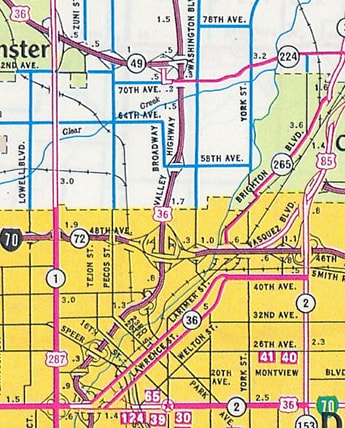
c. 1968, CDoT
Incidentally: at that time, from the I-25/Colfax interchange, it was possible to go three different directions on a "highway 36": east on Colfax, northeast on Lawrence, and north on the Valley Highway. So it is easy to see why the Lawrence/Larimer couplet was redesignated as SH 33 the next year, as shown on the following map:
c. 1969, CDoT
That map also illustrates that the US 285 designation had been removed from the Morrison Road corridor. Traffic was instead directed around Denver via a sort of beltway that consisted of Hampden Avenue and Havana Street, to a new terminus at Colfax (US 36-40-287).
The winter edition of the 1970 map was the first to show I-270 complete between I-70 and what is now I-76 (but at the time was still designated as I-80S). The 1970 summer edition was the first to show that US 36 had been redirected off of Colfax and onto I-70 / I-270 / I-80S / I-25 to the Boulder Turnpike: 
c. 1970, CDoT
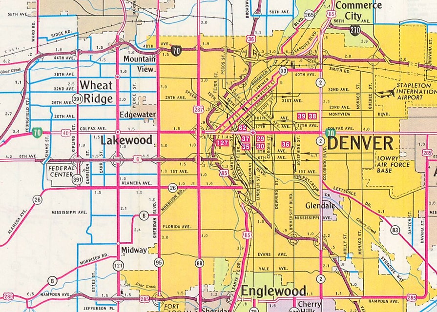
In 1978, US 285 attained its current configuration when it was truncated to its interchange with I-25. This may have been done because I-225 had recently been completed, and since Denver now had a freeway bypass around the south and east sides, perhaps US 285's surface-level beltway was deemed obsolete. The former US 285 from I-25 up Havana to 6th Av became an extension of the SH 30 designation, while the one-mile segment from 6th to Colfax was removed from the state highway system:
c. 1969, CDoT
Around the turn of the century, construction began on a project that would extend I-270 across I-76, allowing it to directly connect with I-25 and the Boulder Turnpike. The westbound connection was completed in 2000, and three years later the eastbound connection was opened to traffic. This removed all US 36 traffic from I-76 and I-25, allowing it to remain on I-270 between the Turnpike and I-70. In this way US 36 attained its current configuration...
...although it should be noted that this is an implied routing, because US 36 is not signed anywhere along its 42-mile concurrency with interstates 70-270 (between Denver and Byers). In the 1990s or 2000s, I vaguely recall a sign on eastbound I-70 directing US 36 traffic to use I-270, but as of 2017 no such signage remained. In fact, several US routes in the Denver area now follow implied routings. That is because at some point CDoT made it their policy not to sign US routes along interstate overlaps. This was probably an attempt to reduce sign clutter, minimize expenses, and/or simplify inventory. But one major drawback is that, besides US 36, there are three additional US routes (US 6, US 85, and US 87) for which it is no longer possible to rely on directional signage to navigate through the Denver area.
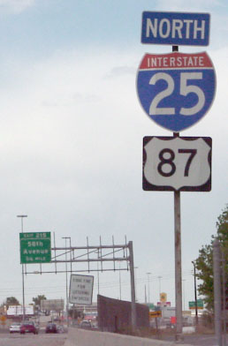
Actually, there are no longer any US 87 signs anywhere in Colorado, because that route is concurrent with I-25 through the entire state. Historically this assembly was posted on northbound I-25, in the gore right where US 85 traffic merged in from the left:
Ballard
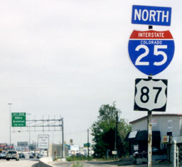
That disappeared sometime in the mid-1990s (and later that interchange was redesigned; US 85 no longer merges in from the left). After that, there was only one US 87 sign left anywhere in Colorado: on northbound I-25, north of I-70. Until 2001, it was on a three-digit blank...
Sanderson, 2001
...but CDoT (or a contractor) replaced the assembly in 2002:
Sanderson, 2002
That remained standing until August 2012; since then there is no signed evidence of US 87 in Colorado.
US 6 and US 85 are both signposted in the Denver area, but not where they are concurrent with I-25, and not at the exchanges between I-25 and I-70. Interestingly, as of 2018, there were still four assemblies on I-70 indicating the US 6-85 overlap. But they are kind of pointless, because for traffic heading south on Vasquez (US 6-85), drivers are not told that those routes continue to the west on I-70. Also, for traffic heading north on Santa Fe (US 85) or east on the 6th Ave. Freeway (US 6), there is no signage informing drivers that those routes continue to the north along I-25. CDoT certainly does not make it easy for travelers to follow US routes through the state.
Research and/or photo credits: Mike Ballard; Matt Salek; Dale Sanderson; Michael Summa
2 Comments
Max
5/9/2021 01:43:01 am
Stellar research here gentlemen and a big help in understanding Denver’s labyrinth highly genealogy.
paul jarrett
5/10/2021 07:27:59 pm
Good info outlining the history of Denver/Front Range road systems. Your comment will be posted after it is approved.
Leave a Reply. |
AuthorCategories
All
Archives
July 2024
|
 RSS Feed
Copyright © 1998-2024
