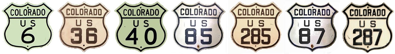
(Most recently updated 3/5/2022.) Today, Denver is served by seven different US routes (shown above), but when the US highway system was first commissioned in late 1926, only three routes went through Denver. AASHO officials acknowledged the city's importance by placing it at the junction of a major north-south route (US 85, which ran from a Canadian port of entry almost to Mexico) and a transcontinental east-west route (US 40, which connected Atlantic City NJ to the San Francisco Bay Area):
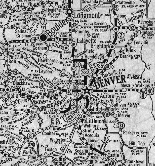
c. 1927, Rand McNally
2 Comments
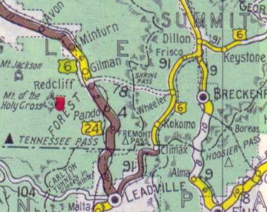
Shrine Pass was not considered to be a good candidate for development into a primary state highway, so US 6 traffic was directed further south from Copper Mountain, along today's SH 91. Drivers had to go over Fremont Pass and all the way down to Leadville. There, traffic was directed north (overlapped with westbound US 24) over Tennessee Pass and up to Minturn.
(most recently updated 5/25/2023)
In 2001 construction began on Denver's "T-Rex" project (TRansportation EXpansion). This involved widening I-25 and adding light-rail service along the corridor through the south metro area. It was a great investment benefitting Denver commuters, but one unfortunate casualty was the old Colorado and Southern Railway bridge over I-25 (and unmarked US 87), just north of Evans Avenue. The rail line had not been used for years, but its bridge was a cool landmark that provided a little extra character in south Denver. |
AuthorCategories
All
Archives
July 2024
|
 RSS Feed
Copyright © 1998-2024
